Rural case study: Tel Hadya, Syria
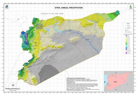
Tel Hadya (the Aleppo plateau, Syria) is an area that covers approximately 70,000 km2. Average annual precipitation varies from 500 mm in the hilly northwest to 200 mm in the southeast (see map above). The climate is Mediterranean with rain occurring during the cold winter season (October to May) and almost no rain during the hot summer season. A succession of droughts and an increase in groundwater abstraction has left Tel Hadya with a scarcity of water resources. Wheat, the main crop of the drier areas of the region, is vulnerable to the effects of drought and high temperatures particularly in spring. Irrigation is only possible where there are sufficient water resources. Key research issues for the case study include water resource allocation, the combined effects of increasing temperature and CO2 on wheat production, and the use of irrigation for future climate.
Documents
Tel Hadya information sheets:
 Observed climate
- Current impacts and vulnerability
- 'Future' climate and impacts
- Stakeholder engagement and adaptation options
Tel Hadya case-study indicators
Leading team
This research is coordinated by Theib Oweis, Mohammed Karrou and Rolf Sommer, ICARDA, Syria