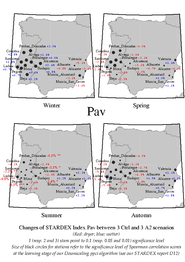
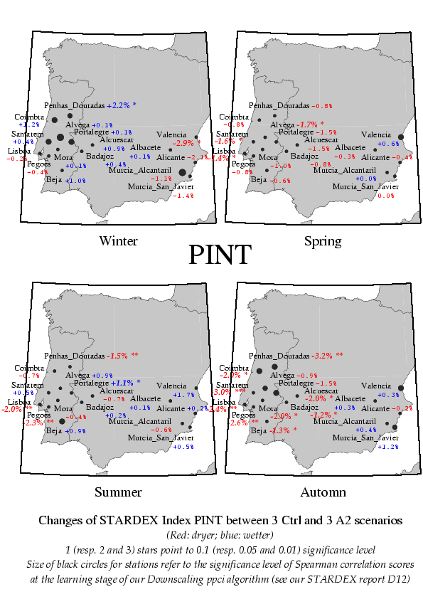
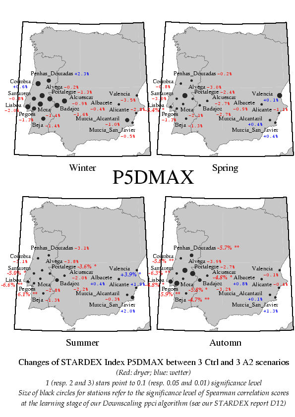
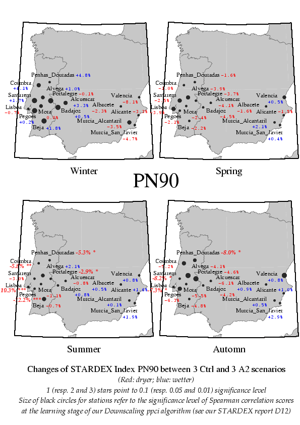
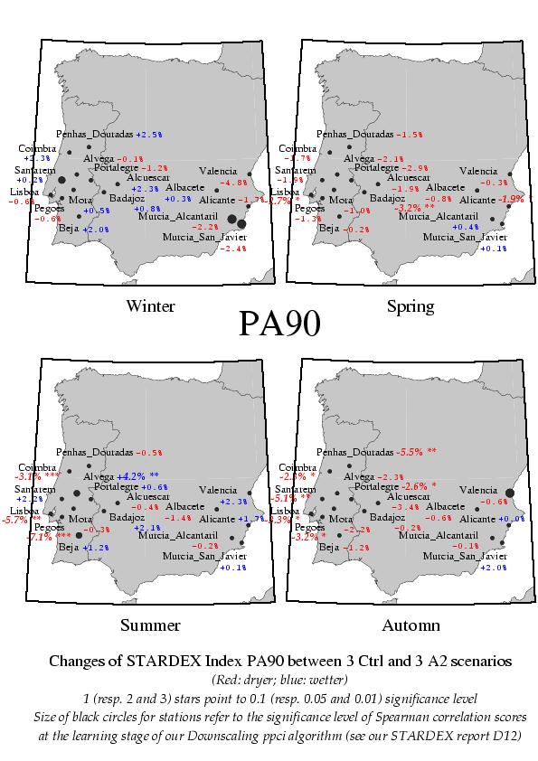
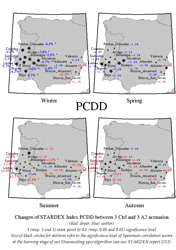
Change between 1961-1990 and 2071-2100. Figures are percentages. Blue figures: changes to wetter conditions. Red figures: changes to dryer ones.
Average change between three ensembles in each time slice. For SRES emission scenario A2. Driving GCM: HadAM3P.
The "PPCI" method was developped by CNRS INLN partner 5. It consists in a Downscaling algorithm based on the link existing between Large Scale Circulation and Intense Precipitation Events. For further explanations, see CNRS INLN partner 5 contribution to STARDEX report D12, available on STARDEX WeB site: Downscaling of Extremes for Precipitation over 10 Alpine and 16 Iberian stations; Application of a Stochastic algorithm based on a "Potential Precipitation Circulation Index" ("ppci") defined using NCEP Reanalysed Large Scale Z700 Geopotential field (1958-2000).
Method |
Pav |
Pint |
Px5d |
PQ90 |
PNl90 |
PFl90 |
PxCDD |
|---|---|---|---|---|---|---|---|
PPCI |
Please notice that the "PPCI" algorithm focalizes on changes due to circulation changes.